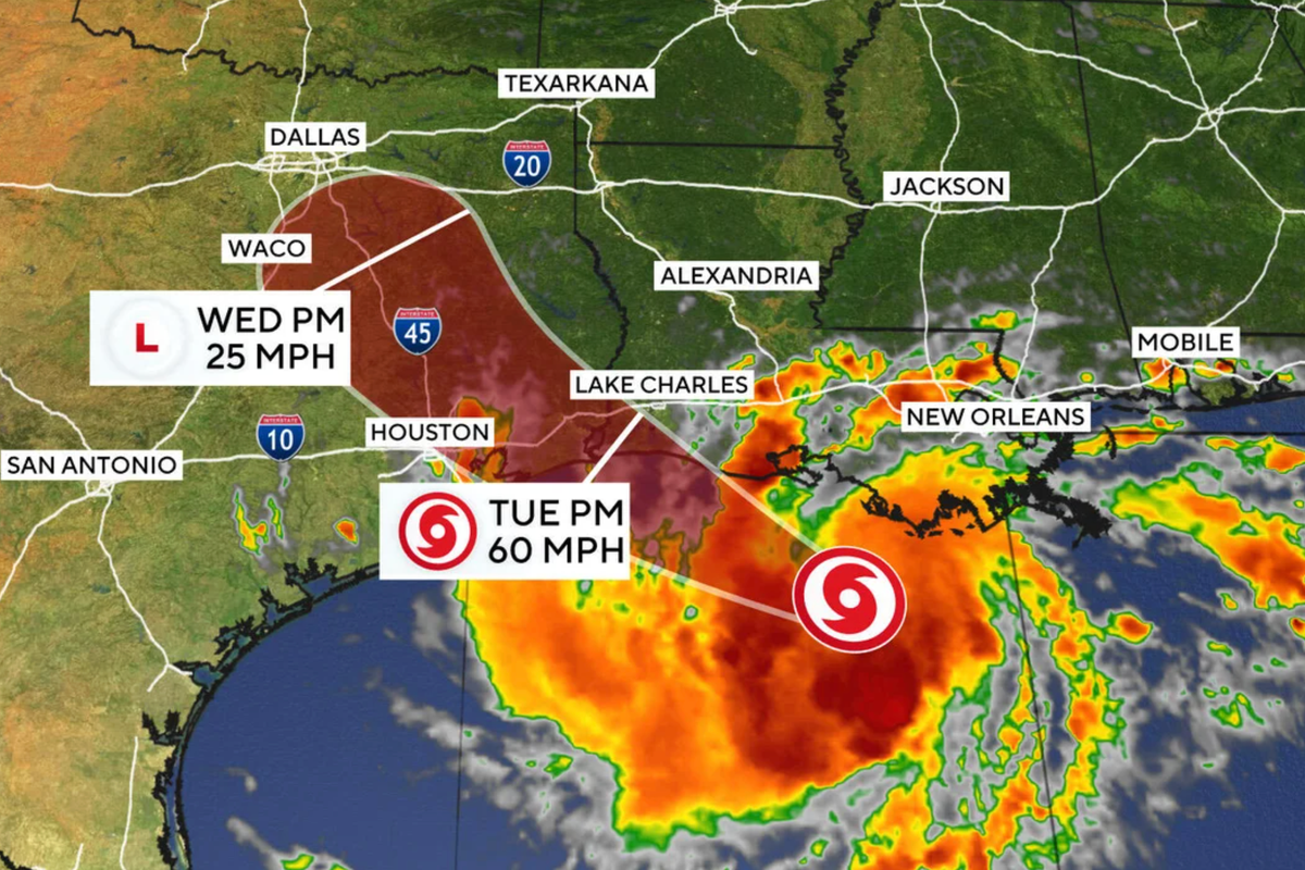
Tropical Storm Edouard is tracking toward the Texas Gulf Coast and is expected to make landfall on Tuesday. Early that morning the system was about 65 miles south‑southeast of Cameron, Louisiana, and 90 miles southeast of Port Arthur, Texas, with maximum sustained winds of 40 mph and a forward speed of 8 mph. The National Hurricane Center noted that the storm could intensify to hurricane strength before reaching the north‑west Gulf Coast.
Forecasters warned that Edouard could unleash heavy rain capable of producing flash flooding. AccuWeather projected 2‑8 inches of rain for Houston and the upper Texas coast, with localized totals of up to 12 inches east of the city. The NHC issued flash‑flood warnings for the Upper Texas coast, east‑central Texas and southwest Louisiana on Tuesday and Wednesday, and a storm‑surge warning from High Island to the Vermilion/Cameron Parish line. Winds in some Gulf‑Coast areas may reach 60 mph.
Texas Governor Greg Abbott said the greatest threat is flooding, with rainfall rates of 3‑4 inches per hour and isolated totals of 10‑15 inches. He announced that state emergency resources, including rescue aircraft, high‑water vehicles and swift‑water boats, are ready for deployment. Abbott urged residents, especially in Harris County, to avoid driving through standing water and warned that strong winds could spark fires that spread rapidly.
Utility officials cautioned that the storm may down power lines, though the Electric Reliability Council of Texas reported no usage restrictions. The National Weather Service kept its tropical‑storm warning in effect for Chambers County and nearby Gulf‑Coast areas through Wednesday morning. Edouard is the fifth named storm of the Atlantic hurricane season, which runs from June through November.