A developing El Niño climate phenomenon in the Pacific Ocean could become the strongest on record, according to Australia’s Bureau of Meteorology. Climatologists are closely monitoring the strengthening El Niño, with forecasts from climate models in the coming months described as ‘mind-blowing’ and ‘astounding.’ The phenomenon is linked to record global temperatures and could work in tandem with global heating to deliver the hottest year on record, either this year or in 2027.
The Bureau of Meteorology has stressed that the strength of an El Niño does not necessarily correlate with the strength of impacts in Australia. However, the system generally brings hotter and drier conditions in winter and spring for southern and eastern parts of the country. A major indicator of the strength of an El Niño is the sea surface temperatures in the equatorial Pacific, known as Niño 3.4. Climate models are suggesting this El Niño could peak between +2.2C and above +3C, surpassing the highest reliable temperature value for previous El Niños.
Dr. Zhi-Weng Chua, a senior climatologist at the bureau, said there is a realistic chance that the peak anomaly of this event will rank in the top events, with a chance it could rank as the highest. He noted that this is remarkable, given climate change and how oceans have been gathering heat in the last few decades. The bureau’s own model has the El Niño peaking at about +3.3C, with the phenomenon staying in place until at least the coming summer.
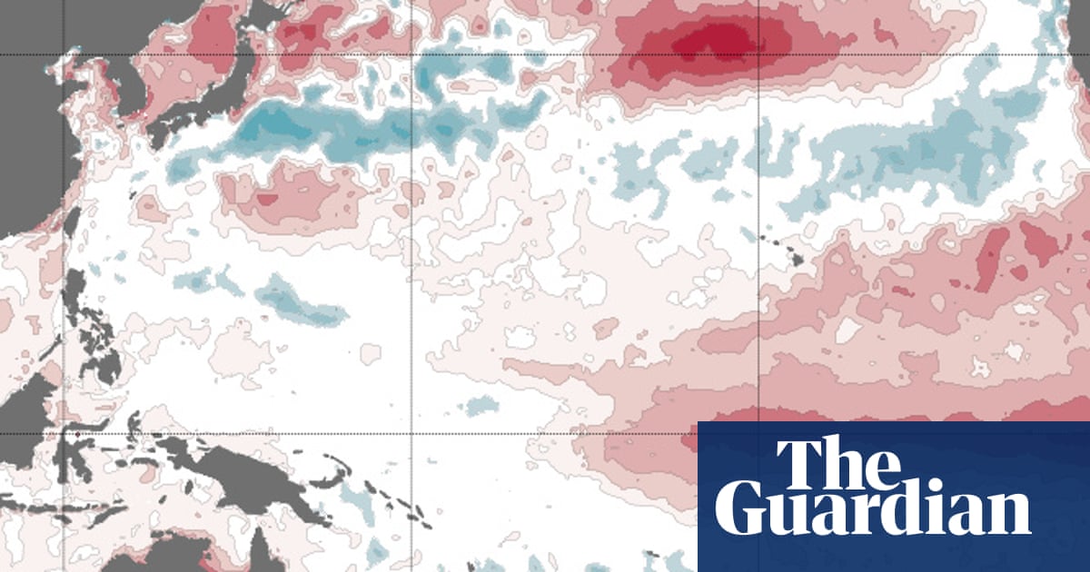
Climate scientists from around the world have reviewed seasonal model forecasts of the Niño 3.4 region, with Dr. Zeke Hausfather describing the forecasts as ‘mind-blowing’ and potentially the strongest event since reliable records began. Current sea surface temperature maps in the Pacific show a huge tongue of unusually warm water extending east from the northern South American coast. Prof. Sarah Perkins-Kirkpatrick, a climate scientist and expert in heat extremes, said the phenomenon is awe-inspiring but deeply concerning, and could be one for the record books.
The Bureau of Meteorology’s latest long-range forecast shows that huge areas of Australia have a high chance of seeing maximum temperatures in the top 20% on record for the period of August to October. Brisbane, Sydney, Melbourne, Hobart, Adelaide, and Perth all have an at least 80% chance of experiencing those temperature extremes, as well as an increased chance of unusually low rainfall. Dr. Kim Reid, an expert on seasonal predictions and rainfall, said if the climate models are right about the El Niño, it would be astounding to see that amount of heat being released from the ocean into the atmosphere, with considerable impacts around the world.
Reid is particularly watching conditions in the Indian Ocean, where some models are predicting cooling in the waters of Australia’s north-west in the coming months. When this phenomenon, known as a positive Indian Ocean Dipole, has combined with El Niño in the past, it has led to very dry periods, such as the ‘tinderbox drought’ which preceded Australia’s black summer bushfires in 2019-2020.